
Reading ZIP Code Directory Coverage
Reading publishes an unusually detailed address-boundary table rather than a simple color map. Its dated ZIP and boundary list identifies ten delivery or post-office-box codes that matter to Reading research. The list uses exact streets and number ranges, so it is stronger than a generic postal map when a parcel sits near an edge. Three codes are described as generally inside the City with stated exceptions, several are mostly or wholly outside with named City pockets, and two identify post-office boxes rather than physical coverage.
| ZIP | Reading coverage | Postal context | Record-search note |
|---|---|---|---|
| 19601 | Generally in the City, with listed fringe-road exceptions | Reading delivery code | Check the street number near outer roads. |
| 19602 | Generally in the City, except stated Loeper Lane and Whitehouse Road ranges | Reading delivery code | Use the exact address against the City table. |
| 19603 | No physical City area stated | Post-office box on North Fifth Street | Obtain the physical address before researching a parcel. |
| 19604 | Generally in the City, with edge-road and number exceptions | Reading delivery code | Apartment and street-number details matter. |
| 19605 | Mostly outside, with listed north-side City pockets | Crosses the City edge | Confirm municipality in the parcel result. |
| 19606 | Mostly outside, with listed east and southeast City pockets | Crosses the City edge | Preserve unit numbers where the City list distinguishes them. |
| 19607 | Outside except listed southern and western pockets | Crosses the City edge | A Reading mailing line does not settle jurisdiction. |
| 19610 | Outside except listed addresses and ranges | Crosses the City edge | Map the parcel and municipal boundary together. |
| 19611 | Generally in the City, with extensive surrounding exceptions | West and south edge detail | Verify addresses near borough lines. |
| 19612 | No physical City area stated | Post-office box on North Thirteenth Street | A box code cannot place a person or property. |
The full City of Reading ZIP and address-boundary table remains the authority for the exception lists. It is sensible to record the street number, street, ZIP, municipality, and parcel ID together before comparing any Reading record.
Reading ZIP Code Exceptions in Core Areas
Codes 19601, 19602, and 19604 can look straightforward because the City describes each as being in Reading except for enumerated exceptions. They are not blanket City labels. The 19601 list includes outer portions of Bernville Road and Schuylkill Avenue among many edge entries. For 19602, the City calls out number ranges on Loeper Lane and Whitehouse Road. The 19604 table separates outlying portions of North Eleventh, North Thirteenth, North Seventeenth, and North Eighteenth streets, and it also distinguishes specified apartment ranges.
Those exceptions affect which local office may hold an address-based City record. A parcel or permit question should begin with the precise house number, not with a ZIP-wide conclusion. When a number appears at the edge, use the City table, then compare the result with the County mapping and property record. Note: The City table is more precise than a postal-code map because its exceptions are written street by street and number by number.
Reading ZIP Code Pockets Beyond the Edge
Reading’s edge codes make the opposite problem common. The City describes 19605 and 19606 as mostly outside Reading except for listed City pockets. It describes 19607 as outside except for stated southern and western pockets, while 19610 has a smaller group of City exceptions. Code 19611 is generally inside, but its exception list is long enough to require an exact-address check. These are delivery patterns, not errors in the records.
The City’s 19606 notes even identify particular Mt. Penn Manor buildings or units. That local detail is why an apartment number must travel with the street address during a Reading ZIP code search. A postal code can narrow the field, but it cannot establish municipal jurisdiction, parcel ownership, or the identity of a current household.
Reading ZIP Code PO Boxes
Two entries in the Reading ZIP code directory need a different approach. The City identifies 19603 as a post-office-box code on North Fifth Street and 19612 as a post-office-box code on North Thirteenth Street. Its instruction is direct: determine the actual physical address. Neither code assigns a physical location to a person, a parcel, or an address-history search.
The City also explains a small but helpful reading rule for its exception table: “up” and “down” refer to the direction of address numbers, not a compass direction. That makes a complete address more useful than a code alone when comparing a postal result with a municipal exception.
Search a Reading ZIP Code by Address
The County’s legacy parcel-viewer documentation records Postal ZIP Code and Municipality as address-point search paths. It is a narrowing tool, not a verified current property-search filter. The Berks Property Records Search publicly describes owner, street-address, and parcel-ID searching, so use the County landing page if an older direct link changes. A ZIP-wide result can include City and non-City addresses because the Reading exceptions cut across delivery areas.
- Enter the complete physical address in the postal lookup and retain the returned ZIP as a delivery result.
- Compare that address with the City’s exception list, including the exact number and unit where relevant.
- Use the County property search or map route to find the parcel and municipality, then save the displayed property identifier.
- For a street-by-street chain after the ZIP is narrowed, use the Reading street directory instead of treating a ZIP result as a resident list.
Voter material does not supply a public ZIP-wide people browse. Pennsylvania Voter Services is an individual registration-status and polling-place service. Berks Election Services is the local custodian for specialized street listings and related files through a written request with the required statutory-use affirmation, so ask the office about an appropriate permitted record instead of trying to turn a postal code into a voter list.
The USPS ZIP Code Lookup is the delivery-address fallback when a record has an uncertain code.
The postal result is a starting point. Reading’s City table and the Berks parcel map supply the local boundary check that a postal screen cannot provide by itself.
Reading ZIP Code Map Search Fields
Berks County’s official legacy help document identifies the fields and controls that can orient a parcel search. These fields come from the map and address-point workflow, so they identify a mapped property context rather than an occupant roster. The County advises using its property-records landing page for the current route because the live interface can change.
| Field or control | Use in a Reading ZIP code search |
|---|---|
| Assessment Site Location | Find a property by its physical address. |
| Emergency Services Location | Use the County-recognized address-point path. |
| Postal ZIP Code | Narrow a map search, not a City-limit determination. |
| Municipality | Cross-check the jurisdiction near a Reading edge. |
| PROPID or UPI | Carry the parcel identifier into an individual property review. |
| Layer List and Basemap | View parcels, address points, roads, and municipal boundaries. |
Use the Berks County property-records page as the stable starting link. The County’s documentation does not support treating any map selection as proof of who lives at an address.
Reading ZIP Code Situs and Mailing Fields
A Reading property record can carry several address concepts. A situs address is the physical property location used in assessment and GIS. A mailing address is a tax or contact address and may be elsewhere. A legal description is the Recorder’s lot, block, subdivision, or metes-and-bounds description. The legal description can carry a deed trail through a numbering anomaly more reliably than a ZIP.
- ZIP versus ZIP+4
- A ZIP identifies a delivery area; the added four digits narrow mail delivery further but do not establish city jurisdiction.
- PO-box ZIP
- A code assigned to postal boxes, not a mapped residential or parcel area.
- Unique ZIP
- A code associated with one organization or delivery arrangement; the Reading City table does not identify 19603 or 19612 as physical unique-property coverage.
- Carrier route
- A postal delivery sequence, useful to mail handling but not a legal parcel boundary.
Keep these fields separate. An owner’s mailing field should not be turned into a claim that the owner lives at the Reading situs address.
Reading ZIP Code Tax Search Limits
Berks County’s online payment search includes Parcel, Location Address, School District, Municipality, Name, Mailing Address, City, and ZIP fields. Its ZIP field filters the owner’s mailing-address information, not necessarily the ZIP of the property itself. It is therefore useful for a payment-routing question, but it should not be used to place a person at a Reading address or to settle a City boundary.
The Berks County online payment search shows the available field set.
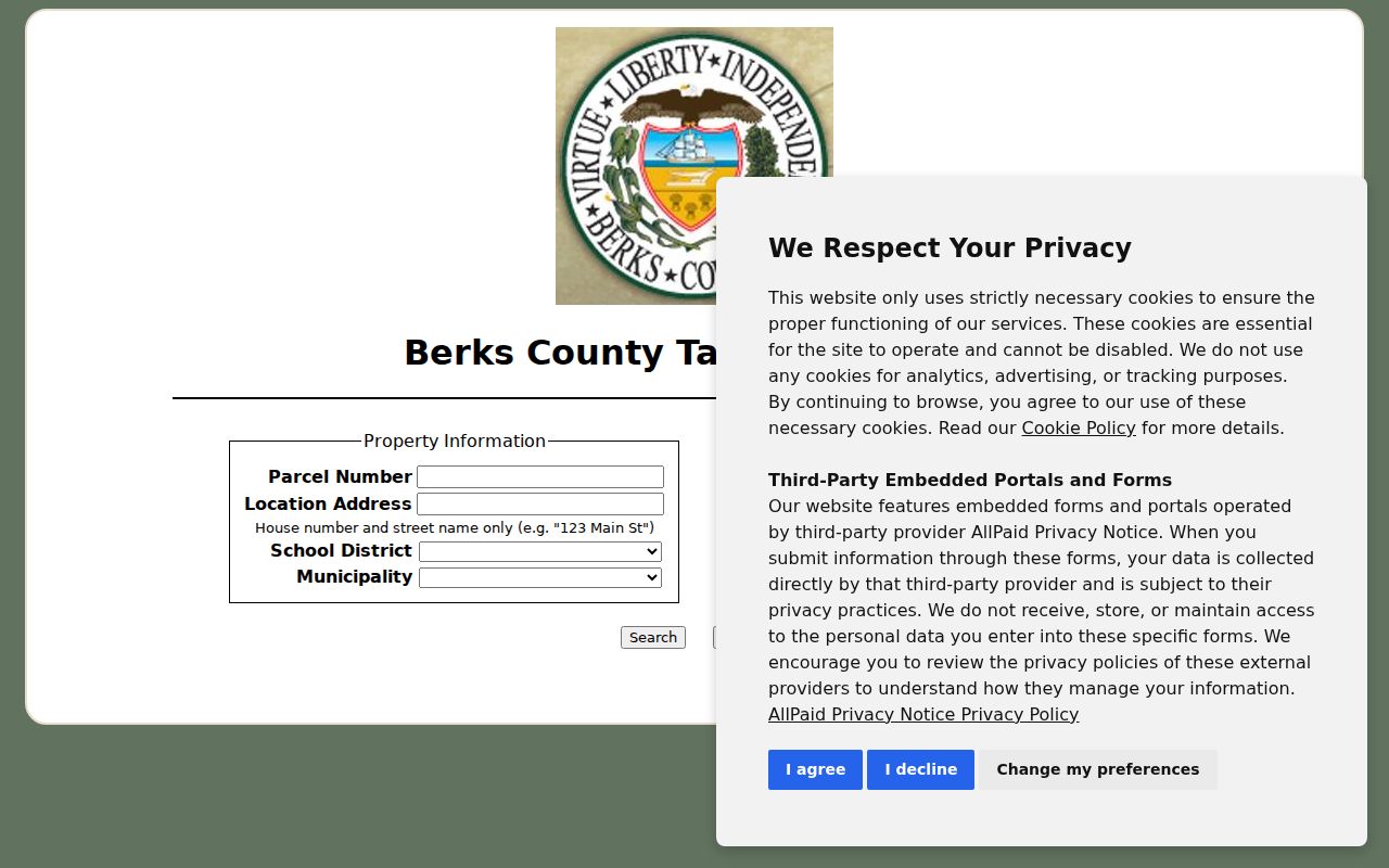
Assessment maintains property information but does not issue tax bills or collect current taxes. For a current-tax or delinquency question, the documented fallback is the relevant tax collector or County Tax Claim channel.
Reading ZIP Code History Needs Other Keys
ZIP codes are modern delivery tools, not a complete historical address key. For an older Reading address, preserve the known street name, number, municipality, parcel identifier, and legal description. The Pennsylvania Room at Reading Public Library has verified telephone-book and map holdings, while exact local reverse-directory coverage was not published in the material reviewed. Ask staff for a specific street, name, and year rather than assuming a ZIP can retrieve an earlier household.
Reading’s early layout also complicates a simple present-day match. The City history says Fifth Street was once called Callowhill, and many street names changed in 1833. Old maps, directory material, and Recorder legal descriptions are better continuity tools than a contemporary postal code.
Reading ZIP Code Boundaries and City Limits
ZIP code boundaries describe mail delivery. Reading city limits describe municipal jurisdiction. The two overlap often, but the City’s own list shows why they cannot be used interchangeably. An address with “Reading, PA” on a mailing line may sit outside City limits, and a City address can appear in a code that mostly serves an adjacent area. Census ZIP Code Tabulation Areas are statistical approximations, so they are not a substitute for USPS and City confirmation.
When no online result resolves the mismatch, contact Berks Assessment for property-record guidance, use the City’s Right-to-Know route for City-held address records, or ask the Pennsylvania Room for historical map and telephone-book help. Each route answers a different question, and none is a general directory of current households.